The Central Highlands Restoration Project (CHiRP) - Overview of Kabirdham
Kabirdham district is one of the 28 administrative districts of Chhattisgarh state in central India. The district was earlier known as Kawardha district. The district is located between 21.32' to 22.28' north latitude and 80.48' to 81.48' east longitude. The district covers an area of 4,447.5 km2 (1,717.2 sq mi). The city of Kawardha is its administrative headquarters. This district is known for the Bhoramdeo temple, located at a distance of 18 km from the district headquarters.
Kabirdham district is a perfect place for the agroforestry development and has enormous natural resources. Kabirdham is located on the southern bank of river Sakri. According to the 2011 census, Kabirdhamhas a population of 8,22,526 with urban population constituting only 10.63%. The scheduled caste population is 12.72% and scheduled tribe population is 20.3%. The district is home to the Baigas and the Gonds, two of the 42 tribes present in Chhattisgarh.The district has 1,852 sq km forest area, which is 43% of the TGA of the district.
The economy of Kabirdham is predominantly agrarian. There are four blocks in Kabirdham- Kabirdham, Bodla, Pandariya and Sahaspur-lohara.
Considering the various factors such as forest abundance, dependence of people on forests, poverty, existing developmental interventions, developmental priorities of state and civil society, tribal population, biodiversity, abundance of potential bamboo / NTFP species, and state of markets, two gram panchayats (local governing body) viz. Dholbajja and Shambhupipar have been selected in the administrative block of Bodla in Kabirdham district as the project area. Traditional livelihoods in these two panchayats are water- and forest-dependent and with depletion and loss of control over both, forced migration patterns have emerged in the area.
Forests of Bodla Block
The forested block of Bodla is part of the Chilphi range, with loamy soil, where Sal (Shorea Robusta) forest along with dry bamboo brakes are thriving. The eastern part of the block is plain and under cultivation; the fields are dotted with individual trees and groves of wild mango. The western portion has tamarind, pipal and mahua trees in abundance. Chilphi hills are covered by forests or scrubs of genera Grewia, Zizyphus, Anogeissus, Adina, Acacia, Dalbergia, Diospyros, Schleichera, Terminalia, Shorea, etc. Among forest trees, saja (Terminalia tomentosa) is abundant (a holy tree for Baigas).
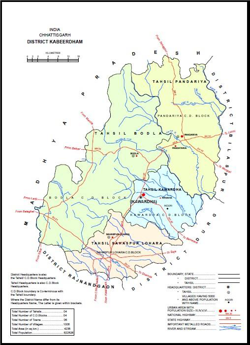
It is proposed to consider the area where both Shambhupipar and Dholbajja Gram Panchayats are located as one landscape with various villages and (micro)-watersheds and intervening forest areas as depicted in the following map. By selecting this landscape, a variety of land uses such as natural forests (both under forest department as well as rights given to communities under CFRs and IFRs), agriculture, wasteland, fallows, streams and habitations can be included for applying a landscape approach.
Challenges
- Boldla block has a traditional food processing and market linkage practices in the region.
- The region is also an important tiger corridor between Kanha and Achanakmar tiger reserves
- The area has seen depletion of forest cover due to land conversion, illegal felling, unsustainable harvest of forest produce and soil erosion
- The prevalent tussle on forest rights between communities and forest department has further complicated the governance of forests
Dholbajja
Gram Panchayat Dholbajja is located in remote forested area; about 16 km from Bodla block headquarters of Kabirdham district.The Primary occupation of the village is agriculture and harvesting of forest produce. All the families are into agriculture directly and indirectly. Primary crops are-
- Almost 34% of the Dholbaja’s population are directly and indirectly involved in the agriculture.
- People of Dholbaja are mostly involved in the agricultural sectors and 19% of the population are agricultural labors
- There are 14% of the population involved on the NTFPs collection
- 400 households' families in Dholbajja dependent on forest produce;
- 150% increase in annual household incomes is possible by ensuring access to ongoing MSPs
Crop intensity in the region
|
S.No. |
Village |
Single crop area (ha) |
Double crop area (ha) |
Total cultivable land (ha) |
Irrigated Land (ha) |
Rainfed area (ha) |
|
1 |
Dholbajja |
380.24 |
8 |
388.24 |
20 |
368.24 |
|
2 |
Shaktipani |
246.72 |
11 |
257.72 |
23 |
234.72 |
|
3 |
Neuratola |
259.12 |
7 |
266.12 |
15 |
258.12 |
|
4 |
Makkekhona |
151.51 |
3 |
154.51 |
8 |
139.51 |
|
5 |
Amanara |
138.32 |
12 |
150.32 |
25 |
141.32 |
|
6 |
Pendri |
162.46 |
4 |
166.46 |
9 |
141.46 |
|
|
Total |
1338.37 |
45 |
1383.4 |
100 |
1283.37 |
Shambupipar
Gram Panchayat Shambhupipar is situated 48 km from its Bodla block headquarter and 73 km from district headquarter. It has four villages and is surrounded by forested hills of Chilphi and has an undulating terrain. Forest produce of Shambupipar such as chirauta, honey, harra, bahera, mahua and tendu leaves are primary source of income from forests. A total of 152 households in this panchayat out of total 232 have been given IFRs over 206 ha. The main residents are from Baiga and Gond tribes.
All 232 households practice agriculture. The landholding ranges between 0.4 acres to 5 acres. Paddy is the most dominant crop with an average production of 10 quintals per acre. The farmers also grow crops such as bajra (pearl millet), chana (gram), sarso (mustard), kodo, kutki, ramtilli (sesame), lauki (bottle gourd), papaya, makka (maize) and jawar (sorghum). Handful of families do poultry, goatery and piggery too.
|
S.No. |
Village |
Total Agriculturalland |
Irrigated land |
Unirrigated land |
Fallow Land |
Single crop land area |
Double crop land area |
|
1 |
Shambhupipar |
152.85 |
6.89 |
145.96 |
3.37 |
142.26 |
10.59 |
|
2 |
Mahlighat |
263.22 |
7.44 |
255.78 |
5.77 |
152.18 |
11.04 |
|
3 |
Barhapani |
249.04 |
0 |
249.04 |
4.77 |
240.76 |
8.28 |
|
4 |
Kabripathra |
64.99 |
0 |
64.99 |
0.61 |
59.05 |
5.94 |
|
Total |
730.1 |
14.33 |
715.77 |
14.52 |
594.25 |
35.85 |
|
The ten villages of the above-mentioned gram panchayats in the Kabirdham district consist of 97% tribal population, most of which are dependent on agriculture and the forests for sustenance and livelihoods. Additionally, handicrafts made by 500 traditional bamboo artisans constitutes the livelihoods basket in the two panchayats.
Local Existing Markets
The nearest market to Shambhupipar Gram Panchayat is Bokkarkhar. The Bokkarkhar market is further fed by Chilphi market. Similarly, to the east is Dholbajja, which is fed by Bodla market further to the east of Dholbajja. Bodla is a permanent market and also biggest in area.The weekly haat bazar (local market) is the major trade centre for the region in Chilphi. Chilphi market is fed by Jabalpur and Bodla, which has resulted in creating a demand for clothes and fashion that was earlier not a part of the expenditure of the local community. People are still using paddy as currency in barter system.
Market Linkage Challenges
- The products in abundance in the community has visibly lowest stalls in the market compared to stalls selling vegetables, fruits, millets, etc.
- High value NTFPs such as lac, banjeera (Vermoniaanthelmintica), chirauta, mahua and sal seeds are sold to procurers / traders from the Bokkrakar and Bodla markets.
- In the absence of functioning institutions created by government to buy these forest products, the community ends up selling their produce to these limited shops who are basically procurers.
- The monopoly of procurers means the control over price is dictated by them
- Supply chain opportunities are less and traceability of the NTFPs are not possible in the current setup